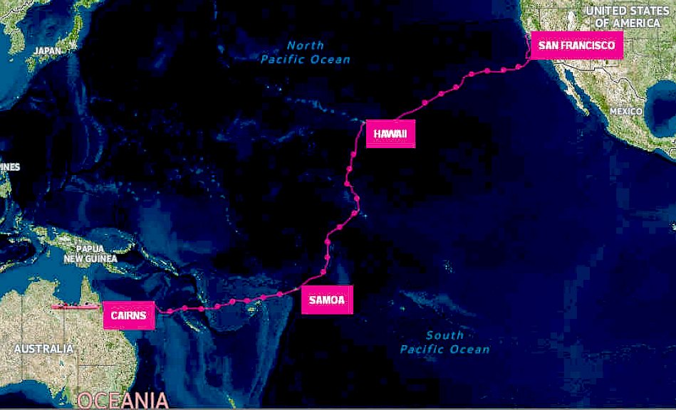
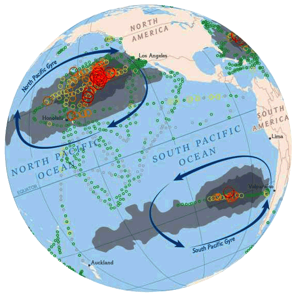
And these plastic micro-beads and micro-fibers could be potentially a logical answer to why the two red spots located in the middle of the oceans next to Japan and above NZ!!!
Perhaps due to ocean currents at the time/moment!
Q
Below: Interesting when looking at the right-hand side surrounding Japan and further left??? Also the spot just above NZ???
Where do these two spots located in the middle of oceans come from???
UQ

Average carbon dioxide concentrations, Oct. 1 - Nov. 11, 2014, measured by the Orbiting Carbon Observatory-2 satellite. NASA
Perhaps due to ocean currents at the time/moment!
Q
Below: Interesting when looking at the right-hand side surrounding Japan and further left??? Also the spot just above NZ???
Where do these two spots located in the middle of oceans come from???
UQ
Average carbon dioxide concentrations, Oct. 1 - Nov. 11, 2014, measured by the Orbiting Carbon Observatory-2 satellite. NASA
Carbon dioxide flux over China, measured by NASA’s Orbiting Carbon oservatory-2 satellite. Image: NASA
The job of monitoring Earth’s carbon cycle and humanity’s carbon dioxide emissions is increasingly supported from above, thanks to the terabytes of data pouring down to Earth from satellites.
https://blogs.csiro.au/ecos/carbon-cycle/

Below: Interesting when looking at the right-hand side surrounding Japan and further left??? Also the spot just above NZ???
Where do these two spots located in the middle of oceans come from???
https://theconversation.com/watchin...studying-earths-carbon-cycle-from-space-72344
Average carbon dioxide concentrations, Oct. 1 - Nov. 11, 2014, measured by the Orbiting Carbon Observatory-2 satellite. NASA
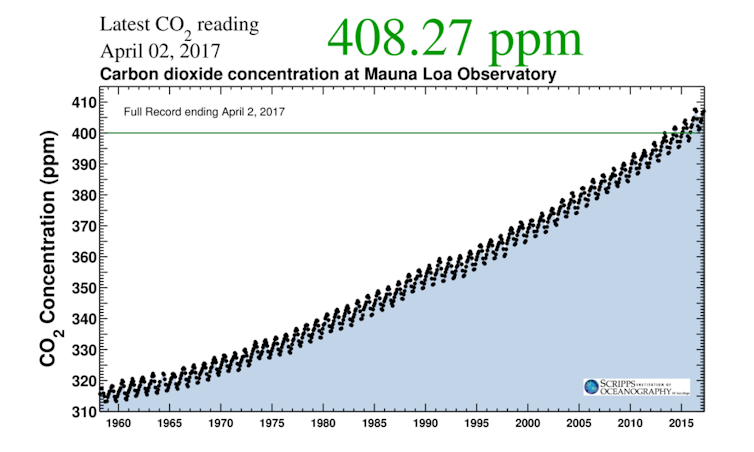
Recorded starting in 1958 by the late geochemist Charles David Keeling, the Keeling curve measures atmospheric carbon dioxide concentrations. Scripps Institution of Oceanography
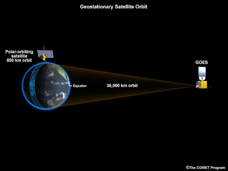
Geostationary satellites like Geo-Carb and the GOES weather satellites (shown here) are positioned over the equator at an altitude of about 36,000 km (or 22,300 miles) above Earth’s surface and orbit at the same speed as the Earth’s rotation, making them appear to stand still. OCO-2, like the Low Earth satellite shown here, samples a much narrower area. UCAR
Last edited: